Recent Changes - Search:

add Trips page

hide Trips

Trips


hide Topics

Topics

show Changed

Changed

Visitor's book Site map pmwiki-2.3.37

2010-04-20 Matakitaki - D'Urville circuit

for photos pages for maps page for photos pages for main page for day pages add main page trail

All maps

Day 0 Wellington, Picton, St Arnaud

2010-04-19 17.28.29 P1010197 Simon.jpeg: 4000x3000, 4477k (2010 Apr 19 17:28)
Likely lads: two Aussies, two kiwis, waiting for the Aratere ferry
2010-04-19 20.53.02 P1010198 Simon.jpeg: 3000x4000, 4464k (2010 Apr 25 21:24)
Mr "Gold Coast"
2010-04-19 20.53.19 P1010199 Simon.jpeg: 3000x4000, 5121k (2010 Apr 25 21:24)
"DoC" from Tinakori
2010-04-19 20.53.33 P1010200 Simon.jpeg: 3000x4000, 4084k (2010 Apr 25 21:24)
"Doctor" from Tassie
2010-04-19 20.56.19 P1010202 Simon.jpeg: 3000x4000, 4069k (2010 Apr 25 21:24)
Mr "Hutt"


day 1 map

480m to 530m
Mataki Lodge to Downies Hut

Day 1 Matakitaki, Downie Hut

2010-04-20 08.09.12 P1010203 Simon.jpeg: 4000x3000, 6673k (2010 Apr 20 08:09)
St Arnaud(approve sites) accommodation(approve sites)
2010-04-20 11.29.16 P1010204 Simon.jpeg: 4000x3000, 6257k (2010 Apr 20 11:29)
Looking up the Matakitaki River
2010-04-20 12.15.15 P1010205 Simon.jpeg: 4000x3000, 7280k (2010 Apr 20 12:15)
Lunch spot
2010-04-20 13.18.58 P1010206 Simon.jpeg: 4000x3000, 6734k (2010 Apr 20 13:18)
Making progress up the Matakitaki valley
2010-04-20 15.34.38 P1010209 Simon.jpeg: 4000x3000, 6474k (2010 Apr 20 15:34)
Nearing the end of the vehicle track
2010-04-20 15.44.14 P1010210 Simon.jpeg: 4000x3000, 6550k (2010 Apr 20 15:44)
Hut in sight
2010-04-20 16.11.27 100_0471 Alan.jpeg: 3664x2748, 1610k (2010 May 22 22:05)
Flats outside hut
2010-04-20 16.19.48 P1010211 Simon.jpeg: 4000x3000, 6927k (2010 Apr 20 16:19)
Historic Downie Hut(approve sites)
2010-04-20 16.29.48 P1010216 Simon.jpeg: 4000x3000, 5097k (2010 Apr 20 16:29)
Inside, relaxing with an escaped convict
2010-04-20 17.10.41 P1010217 Simon.jpeg: 3000x4000, 3180k (2010 Apr 25 21:24)
Waiting for dinner, cooking in the background
2010-04-20 18.31.02 100_0476 Alan.jpeg: 3664x2748, 753k (2010 May 22 22:00)
Sunset, moonrise


day 2 map

530m to 900m
Downies Hut to East Matakitaki Hut

Day 2 Downie Hut, East Matakitaki Hut

2010-04-21 08.52.33 P1010219 Simon.jpeg: 4000x3000, 7118k (2010 Apr 21 08:52)
Leaving Downie Hut as the cold mist rises
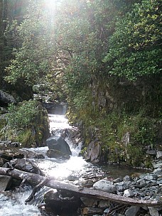
2010-04-21 09.48.18 100_0478 Alan.jpeg: 2748x3664, 1889k (2010 May 22 22:04)
Side creek in the sun
2010-04-21 11.30.45 100_0482 Alan.jpeg: 2736x3664, 2718k (2010 May 30 22:47)
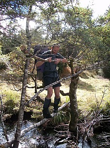
Pretty bridge
2010-04-21 12.48.18 P1010222 Simon.jpeg: 4000x3000, 7064k (2010 Apr 21 12:48)
Lunch in the sun
2010-04-21 13.50.14 P1010223 Simon.jpeg: 3000x4000, 6276k (2010 Apr 25 21:24)
Three wire bridge
2010-04-21 13.52.00 P1010224 Simon.jpeg: 3000x4000, 5827k (2010 Apr 25 21:25)
Across the East Matakitaki
2010-04-21 13.53.02 P1010225 Simon.jpeg: 3000x4000, 6246k (2010 Apr 25 21:25)
Deep clear water
2010-04-21 14.56.59 P1010226 Simon.jpeg: 4000x3000, 6116k (2010 Apr 21 14:56)
River flats and Mountain Beech forest
2010-04-21 15.50.22 P1010227 Simon.jpeg: 4000x3000, 5212k (2010 Apr 21 15:50)
Arriving at East Matakitaki hut(approve sites)
2010-04-21 15.53.22 P1010230 Simon.jpeg: 4000x3000, 5973k (2010 Apr 21 15:53)
Looking downstream East Matakitaki


day 3 map

900m to David Saddle 1,786m to 980m
East Matakitaki Hut to Upper D'Uville Biv via David Saddle

Day 3 East Matakitaki Hut, David Saddle, D'Urville Biv

2010-04-22 08.12.30 P1010231 Simon.jpeg: 4000x3000, 6294k (2010 Apr 22 08:12)
Leaving with a frost on the ground
2010-04-22 09.25.22 P1010232 Simon.jpeg: 4000x3000, 6889k (2010 Apr 22 09:25)
No track up the valley from the hut
2010-04-22 10.41.52 P1010233 Simon.jpeg: 4000x3000, 6813k (2010 Apr 22 10:41)
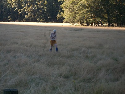
Beautiful day
2010-04-22 11.53.45 P1010236 Simon cropped.jpg: 3800x2723, 1770k (2010 Apr 25 21:35)
Lunch looking up at David Saddle
2010-04-22 12.09.60 Panorama Simon.jpeg: 9371x2470, 6383k (2010 Apr 25 21:40)
Panorama of the East Matakitaki
2010-04-22 12.55.09 100_0504 Alan.jpeg: 3664x2748, 2395k (2010 May 22 22:11)
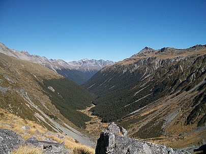
Looking down the East Matakitaki
2010-04-22 13.47.25 100_0511 Alan.jpeg: 2748x3664, 1785k (2010 May 22 22:13)
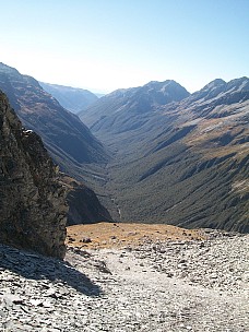
Looking down the D'Urville
2010-04-22 14.03.53 P1010241 Simon.jpeg: 4000x3000, 6940k (2010 Apr 22 14:03)
Down the East Matakitaki
2010-04-22 14.04.60 Panorama Simon.jpeg: 6299x2525, 4921k (2010 Apr 25 21:52)
Panorama of David Saddle and the D'Urville valley
2010-04-22 14.06.60 Panorama Simon.jpeg: 5263x4002, 5839k (2010 Apr 25 21:49)
David Saddle
2010-04-22 15.45.57 P1010249 Simon.jpeg: 4000x3000, 6158k (2010 Apr 22 15:45)
Descent to D'Urville River
2010-04-22 16.39.07 P1010250 Simon.jpeg: 4000x3000, 6843k (2010 Apr 22 16:39)
Upper D'Urville Hut(approve sites) actually a bivvy


2010-04-22 12.11.60 Panorama Simon.jpeg: 10000x1993, 11591k (2010 Apr 26 19:52)
Panorama of East Matakitaki River headwaters
2010-04-22 14.05.60 Panorama Simon.jpeg: 10000x1452, 10374k (2010 Apr 26 19:52)
Panorama of David saddle


day 4 map

980m to 560m
Upper D'Urville Biv to Morgan Hut via George Lyon (Ella) Hut

Day 4 D'Urville Biv, George Lyon Hut, Morgan Hut

2010-04-23 09.54.34 100_0515 Alan.jpeg: 2748x3664, 986k (2010 May 22 22:15)
View back to David Saddle
2010-04-23 10.41.56 P1010255 Simon.jpeg: 3000x4000, 5041k (2010 Apr 25 21:25)
Rest on D'Urville track
2010-04-23 10.43.38 P1010256 Simon.jpeg: 4000x3000, 6509k (2010 Apr 23 10:43)
Feeling good
2010-04-23 13.35.56 P1010257 Simon.jpeg: 4000x3000, 7124k (2010 Apr 23 13:35)
George Lyon Hut(approve sites)


day 5 map

560m to 480m to Tiraumea Saddle 672m
to Mole Tops 1,340 to 1,160m
map day 5.jpeg: 1653x2363, 1355k (2010 May 22 19:10)

Day 5 Morgan Hut, Tiraumea Saddle, Tiraumea Hut, Mole, Mole Hut

2010-04-24 08.18.27 P1010258 Simon.jpeg: 4000x3000, 5496k (2010 Apr 24 08:18)
Morgan Hut(approve sites)
2010-04-24 08.23.35 P1010259 Simon.jpeg: 4000x3000, 4779k (2010 Apr 24 08:23)
Leaving Morgan Hut
2010-04-24 09.01.48 P1010261 Simon.jpeg: 4000x3000, 6832k (2010 Apr 24 09:01)
Looking up the D'Urville
2010-04-24 10.54.56 100_0518 Alan.jpeg: 3664x2748, 2060k (2010 May 22 22:17)
2010-04-24 11.08.49 100_0522 Alan.jpeg: 3664x2748, 1509k (2010 May 22 22:19)
2010-04-24 11.09.00 100_0523 Alan.jpeg: 3664x2748, 1634k (2010 May 22 22:22)
2010-04-24 12.13.17 100_0525 Alan.jpeg: 3664x2748, 2410k (2010 May 22 22:25)
2010-04-24 12.13.39 100_0526 Alan.jpeg: 3664x2748, 2304k (2010 May 22 22:28)
2010-04-24 12.13.51 100_0527 Alan.jpeg: 3664x2748, 2392k (2010 May 22 22:31)
2010-04-24 12.22.49 100_0528 Alan.jpeg: 3664x2748, 2413k (2010 Jun 01 21:03)
2010-04-24 12.44.29 P1010262 Simon.jpeg: 4000x3000, 6156k (2010 Apr 24 12:44)
Tiraumea Hut(approve sites)
2010-04-24 13.41.14 P1010263 Simon.jpeg: 4000x3000, 6988k (2010 Apr 24 13:41)
Looking down to Tiraumea flats and hut
2010-04-24 16.18.02 P1010264 Simon.jpeg: 4000x3000, 6521k (2010 Apr 24 16:18)
Reaching the Mole Tops
2010-04-24 16.37.05 P1010265 Simon cropped.jpg: 3840x3000, 1237k (2010 Apr 25 21:56)
Mole tops in cloud


day 6 map

1,160m to 480m
Morgan Hut to Mole Hut via Tiraumea Saddle and Hut

Day 6 Mole Hut, Mole Creek

2010-04-25 07.04.58 P1010268 Simon cropped.jpeg: 4000x2400, 4294k (2010 Apr 26 19:45)
07:00 hours Mole Hut
2010-04-25 07.06.31 P1010269 Simon cropped.jpeg: 4000x2500, 4711k (2010 Apr 26 19:46)
The ghost of Mole Hut
2010-04-25 08.53.30 P1010270 Simon.jpeg: 3000x4000, 5596k (2010 Apr 25 21:25)
Near bottom of benched track


map NelsonLakesTrip.jpeg: 1422x2382, 1160k (2010 Jun 02 20:46)

Trip information

Brekkies:
  • 2 porridges, with milk powder and sugar
  • 2 rice flakes, sultanas and cinnamon
  • 1 muesli (for the last morning, when we have to make an early start)
Dinners:
  • 2 mac cheeses (incl salami, dehy pineapple, dehy veges)
  • 2 rice and tuna (incl cashews, dehy veges)
  • 1 curry sausages and spud (dehy spud, Italian sausages (pre-cooked), dehy veges, curry) - for the first night
Puds:
  • 1 cheesecake
  • 1 mousse and dehy apricots

Party gear:

  • tent fly
  • MSR dragonfly primus
  • 2 litres fuel (two aluminium bottles)
  • 2 billies, 6pt, 8pt
  • 2 billy cleaners & detergent
  • 1:50,000 maps - NZMS 260s - M29 and M30
  • cards
  • mountain radio(approve sites)
  • PLB
Personal:
  • 5 lunches
  • first aid, candle
  • sleeping mat
  • GPS
  • bivvy bag

Total distance

  • ~80km tramped
  • ~250km road Wellington to Wellington

tahi Page last modified on 2018 Jul 10 15:12

Edit - History - Recent Changes - WikiHelp - Search - email page as link -> mailto:?Subject="KiwiWiki: 2010-04-20 Nelson Lakes"&Body=