
|
Trips
Topics |
2026-03-01 Waitāwhiri2026-01-29 Hokkaidō skiing < Trips > 2026-08-17 Te Aruhe Pora
Monday 02 March 2026, day 01Rangiora driving to the Wilberforce canal, crossing te awa Waitāwhiri, tramping to Manuels Hut 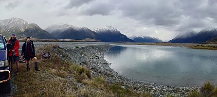 Bruce and Brian at the end of the Wilberforce canal stopbank 📷 Simon  Waitāwhiri rest stop Bruce and Simon 📷 Brian  Waitāwhiri rest stop Brian and Bruce 📷 Simon  Bruce and Simon arriving at Manuels Hut 📷 Brian  Bruce and Simon arriving at Manuels Hut 📷 Brian 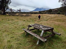 Brian arriving at Manuels Hut 📷 Simon 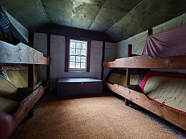 Inside Manuels Hut 📷 Simon  Manuels Hut 📷 Simon  Manuels Hut 📷 Simon  Manuels Hut 📷 Simon  Bruce outside Manuels Hut with snow in the background 📷 Simon  Simon and Bruce outside Manuels Hut 📷 Brian Tuesday 03 March 2026, day 02Manuels Hut to Moa Stream Hut via Moa Hut for lunch  View down the valley from Manuels Hut 📷 Simon 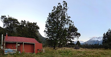 Manuels Hut 📷 Simon  Simon and Bruce at breakfast Manuels Hut 📷 Brian  Heading up te Waitāwhiri 📷 Brian  Rest stop beside te Waitāwhiri 📷 Brian  Rest stop beside te Waitāwhiri 📷 Simon  Brian and Bruce a rest stop before Takahe Stream 📷 Simon  Brian and Bruce on Kiwi Flat 📷 Simon 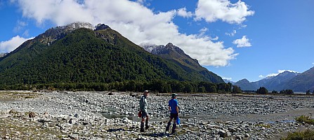 Bruce and Brian looking acress Moa Stream 📷 Simon  Bruce and first glimpse of Moa Hut 📷 Brian  Inside Moa Hut 📷 Simon 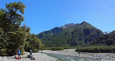 Rest stop in Moa Stream 📷 Simon Wednesday 04 March 2026, day 03Moa Stream Hut via North Stream and Moa Saddle to Unknown Hut  Brian and Bruce starting up Moa Stream 📷 Simon  Bruce heading up Moa Stream 📷 Brian  Early steps up North Stream 📷 Simon  Second rest stop in Moa Stream 📷 Brian  Unknown Stream from Moa Saddle 📷 Brian  Bruce arriving at Moa Saddle from Moa Stream 📷 Brian  Rocky nerg at Moa Saddle 📷 Brian  Simon and view of Unknown Stream 📷 Brian  The Moa Saddle rocky nerg 📷 Brian  Leaving Moa Saddle 📷 Simon  At Unknown Hut 📷 Brian  Bruce at Unknown Hut 📷 Brian Thursday 05 March 2026, day 04Unknown Hut to Urquhart's Hut; return trip to Park Morpeth Hut  Morning in Unknown Stream 📷 Simon  Into the sun down Unknown Stream 📷 Brian  Clothing off time in Unknown Stream by Gibson Stream 📷 Simon  Wetland between Unknown Stream and the Wilberforce 📷 Simon  Bruce arriving at Urquhart's Hut 📷 Brian  Inside Urquhart's Hut 📷 Simon  On the way up the Waitāwhiri 📷 Simon  Rest stop at Gifford Stream 📷 Brian  Artefact From The Mining Days 📷 Simon  Bruce and Simon at Park Morpeth Hut 📷 Brian  View up Waitāwhiri at Park Morpeth Hut 📷 Simon  Bruce and Simon inside Urquhart's Hut 📷 Brian Friday 06 March 2026, day 05Urquhart's Hut, crossing te Waitāwhiri, to Weka Burnet Bivvy and Fanghill Hut  Urquhart's hut at dawn stitch str 📷 Simon 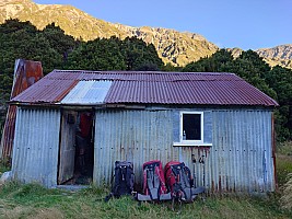 Our packs ready to leave Urquarhart's Hut 📷 Simon 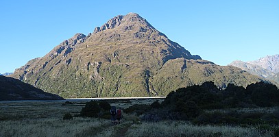 Heading down Waitāwhiri flats 📷 Brian  Heading down the Waitāwhiri 📷 Brian  View down Waitāwhiri from Weka Stream fan 📷 Brian  View up Waitāwhiri from Weka Stream fan 📷 Simon  Weka Burnet Bivouac 📷 Brian  Bruce and Brian at Weka Burnet Bivouac 📷 Simon  Brian and Bruce crossing Burnet Stream 📷 Simon  A quick stop in the Waitāwhiri above Bristed Stream 📷 Simon  Bruce and Brian arriving at Fanghill Hut 📷 Simon  Bruce arriving at Fanghill Hut 📷 Brian Saturday 07 March 2026, day 06Fanhill Hut to the Wilberforce Canal; drive to The Retreat  Sunrise from Fanghill Hut 📷 Brian  Early morning at Fanghill Hut 📷 Simon  Bruce outside Fanghill Hut early morning 📷 Simon  Rest stop at Boundary Stream 📷 Simon  Simon and Bruce crossing the Waitāwhiri 📷 Brian  Fitzwilliam Hut 📷 Brian  Fitzwilliam Hut 📷 Brian  The Retreat 📷 Brian  Simon and Bruce at Lake Lilian 📷 Brian  Lake Lilian 📷 Simon  Bruce outside Fitzwilliam Hut 📷 Simon  Simon outside Fitzwilliam Hut 📷 Simon Sunday 08 March 2026, day 07Harper River, Lake Coleridge, Methven, to Rangiora  Breakfast at The Retreat 📷 Simon  The Retreat 📷 Simon  The Retreat 📷 Simon  Mt Fitzwilliam and Fitzwilliam Hut 📷 Simon  Driving in the Harper 📷 Brian  📷 Brian  Lake Coleridge 📷 Simon  TA SOBO at Methven Complete Tramping routeComplete Tramping routeAttach:Trips.2026-03-01Waitāwhiri,Maps/2026-03-02 nzm Wilberforce tramp complete final.gpx
Complete Driving routeAttach:Trips.2026-03-01Waitāwhiri,Maps/2026-03-02 nzm Wilberforce driving complete final.gpx GpxStat: ""Trips.2026-03-01Waitāwhiri,Maps/2026-03-02" not a valid filename
Category: Tramping
|
tahi Page last modified on 2026 Mar 29 14:41
Edit - History - Recent Changes - WikiHelp - Search - email page as link -> mailto:?Subject="KiwiWiki: 2026-03-01 Waitāwhiri"&Body=
